Palato do CôaDouro Superior · Portugal
History

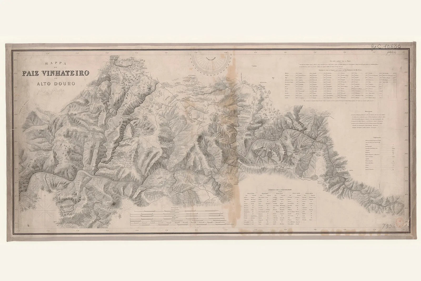
Baron Forrester’s map of the Douro

There is a map behind the bottle. It is not a metaphor: the design of Palato do Côa directly references one of the first rigorous portraits of the Douro.

“Mappa do Paiz Vinhateiro do Alto Douro”, by J. J. Forrester — public domain

Baron Joseph James Forrester, a Scotsman, carried out a topographical and geological survey of the Douro in the mid-nineteenth century. It was the first detailed map of the region — a precise portrait of the river, slopes and estates at a time when much of the Douro had yet to be recorded.

A map on the bottle

The design of Palato do Côa evokes this historic map: the name “MAPA” and the green “zero” point on the bottle refer directly to Forrester’s survey. It is a way of saying, without words, that the wine begins in an exact place — and that this place has a long history.

Origin and exact place

A map is, ultimately, a statement of origin: here, and nowhere else. That is what the Vinha da Migalha does: it comes from an old-vine parcel over fifty years of age and makes three hundred and eighty bottles.

Forrester’s map detailed the eastern frontier of the Douro Superior as far as the point where the River Côa flows into the Douro — a valley that holds a secret far older than any vineyard.

Sources: “Mappa do Paiz Vinhateiro do Alto Douro”, by J. J. Forrester — public-domain scan (Wikimedia Commons). The National Library of Portugal catalogues the work as [1843] (rnod.bnportugal.gov.pt). The survey ran to more than one edition, and the edition reproduced in this image has not yet been identified — which is why the caption gives it no year.

← Douro Superior
Baron Forrester’s map of the Douro — Palato do Côa